 vesseltracker.com
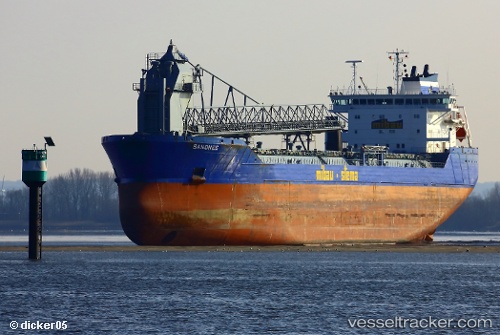
Vessel Sandnes IMO: 9306029, MMSI: 304783000 Self Discharging Bulk Carrier
UTC, 55.41883, 5.84167, course: -1, speed: 7.5
UTC, 55.07753, 5.92303, course: -1, speed: 7.5
2026-03-01 05:41:21 UTC, 54.90683, 5.95167, course: -1, speed: 7.6
Live AIS position:
UTC. 54 nm S of Claonaig),
updated 2026-03-01 05:41:21 UTC.
Find the position of the vessel Sandnes on the map. The latter are known coordinates and path.
marine traffic ship tracker show on live map
The current position of vessel Sandnes is 54.90683 lat / 5.95167 lng. Updated: 2026-03-01 05:41:21 UTCCurrently sailing under the flag of Antigua Barbuda
Sandnes built in 2005 year
Deadweight:
27711 tDetails:
Last coordinates of the vessel:
UTC, 55.58367, 5.79600, course: -1, speed: 7UTC, 55.41883, 5.84167, course: -1, speed: 7.5
UTC, 55.07753, 5.92303, course: -1, speed: 7.5
2026-03-01 05:41:21 UTC, 54.90683, 5.95167, course: -1, speed: 7.6