 vesseltracker.com
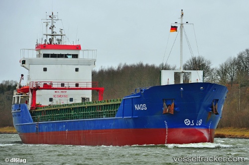
Vessel Naos IMO: 9136137, MMSI: 305269000 Multi Purpose Carrier
UTC, 51.96202, 4.12274, course: 205, speed: 0
UTC, 51.96205, 4.12275, course: 205, speed: 0
2026-01-13 14:27:29 UTC, 51.96322, 4.12502, course: 287, speed: 0.3
Live AIS position:
UTC. Near HOEK VAN HOLLAND),
updated 2026-01-13 14:27:29 UTC.
Find the position of the vessel Naos on the map. The latter are known coordinates and path.
marine traffic ship tracker show on live map
The current position of vessel Naos is 51.96322 lat / 4.12502 lng. Updated: 2026-01-13 14:27:29 UTCCurrently sailing under the flag of Antigua Barbuda
Naos built in 1996 year
Deadweight:
4258 tDetails:
Last coordinates of the vessel:
UTC, 51.96205, 4.12275, course: 206, speed: 0UTC, 51.96202, 4.12274, course: 205, speed: 0
UTC, 51.96205, 4.12275, course: 205, speed: 0
2026-01-13 14:27:29 UTC, 51.96322, 4.12502, course: 287, speed: 0.3