 vesseltracker.com
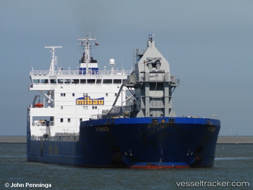
Vessel Fitnes IMO: 9490105, MMSI: 305530000 Self Discharging Bulk Carrier
UTC, 57.83451, 10.02688, course: 263, speed: 11.3
UTC, 57.82733, 9.79402, course: 263, speed: 11.4
2026-01-16 21:45:39 UTC, 57.82224, 9.44526, course: 263, speed: 11.4
Live AIS position:
UTC. 21 nm NW of Hirtshals),
updated 2026-01-16 21:45:39 UTC.
Find the position of the vessel Fitnes on the map. The latter are known coordinates and path.
marine traffic ship tracker show on live map
The current position of vessel Fitnes is 57.82224 lat / 9.44526 lng. Updated: 2026-01-16 21:45:39 UTCCurrently sailing under the flag of Antigua Barbuda
Fitnes built in 2010 year
Deadweight:
33169 tDetails:
Last coordinates of the vessel:
UTC, 57.84040, 10.89750, course: 294, speed: 11UTC, 57.83451, 10.02688, course: 263, speed: 11.3
UTC, 57.82733, 9.79402, course: 263, speed: 11.4
2026-01-16 21:45:39 UTC, 57.82224, 9.44526, course: 263, speed: 11.4