 vesseltracker.com
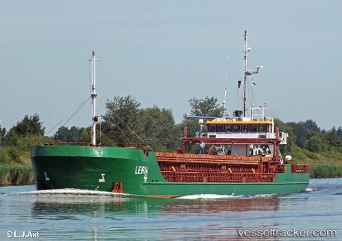
Vessel Leiria IMO: 9248370, MMSI: 305916000 General Cargo Ship
UTC, 45.55867, -1.04990, course: 263, speed: 0
UTC, 45.55833, -1.05167, course: -1, speed: 0
2026-01-29 03:52:08 UTC, 45.56005, -1.05236, course: 146, speed: 0
Live AIS position:
UTC. Near LE VERDON-SUR-MER),
updated 2026-01-29 03:52:08 UTC.
Find the position of the vessel Leiria on the map. The latter are known coordinates and path.
marine traffic ship tracker show on live map
The current position of vessel Leiria is 45.56005 lat / -1.05236 lng. Updated: 2026-01-29 03:52:08 UTCCurrently sailing under the flag of Antigua Barbuda
Leiria built in 2003 year
Deadweight:
2652 tDetails:
Last coordinates of the vessel:
UTC, 45.55794, -1.05001, course: 303, speed: 0UTC, 45.55867, -1.04990, course: 263, speed: 0
UTC, 45.55833, -1.05167, course: -1, speed: 0
2026-01-29 03:52:08 UTC, 45.56005, -1.05236, course: 146, speed: 0