 vesseltracker.com
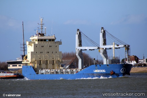
 Langeoog
Current Status
Where is the vessel?
Langeoog is currently in Near Colon, based on AIS data received less than 1h ago.
Latest AIS update:
Current position: 9.36905° N, 79.91345° W (Near Colon)
Average speed (last 7 days): Loading…
Average speed (last 30 days): Loading…
Vessel profile: Langeoog is a Multi Purpose Carrier with dimensions 108m x 16m.
This page combines live AIS, route history, probable destination signals, nearby traffic, and port activity for practical vessel monitoring.
The current position of vessel Langeoog is 9.36905 lat / -79.91345 lng. Updated: 2026-04-07 21:45:05 UTCNearest reference points:
- Near COLON 2000
- Near Colon
- Near Colón Free Zone
Currently sailing under the flag of Antigua Barbuda ![]()
Details:
Live Vessel Langeoog Analytics (details, animations, etc.)
Recent AIS points (UTC):
2026-04-07 16:02:20 UTC · 9.36895, -79.91399 · SOG 0 kn · COG 9°2026-04-07 18:15:04 UTC · 9.36888, -79.91376 · SOG 0.1 kn · COG 350°
2026-04-07 19:51:29 UTC · 9.36891, -79.91355 · SOG 0.1 kn · COG 341°
2026-04-07 21:45:05 UTC · 9.36905, -79.91345 · SOG 0.1 kn · COG 336°