 vesseltracker.com
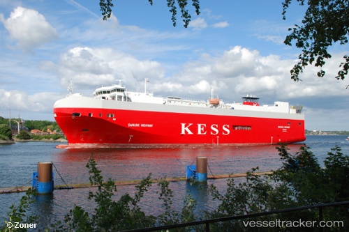
Vessel Danube Highway IMO: 9316309, MMSI: 308803000 Vehicles Carrier
UTC, 55.62330, 12.99618, course: 83, speed: 0
UTC, 55.62331, 12.99619, course: 82, speed: 0
2026-01-19 08:19:49 UTC, 55.62330, 12.99619, course: 82, speed: 0
Live AIS position:
UTC. Near Malmo),
updated 2026-01-19 08:19:49 UTC.
Find the position of the vessel Danube Highway on the map. The latter are known coordinates and path.
marine traffic ship tracker show on live map
The current position of vessel Danube Highway is 55.62330 lat / 12.99619 lng. Updated: 2026-01-19 08:19:49 UTCCurrently sailing under the flag of Bahamas
Danube Highway built in 2006 year
Deadweight:
7788 tDetails:
Last coordinates of the vessel:
UTC, 55.62332, 12.99618, course: 82, speed: 0UTC, 55.62330, 12.99618, course: 83, speed: 0
UTC, 55.62331, 12.99619, course: 82, speed: 0
2026-01-19 08:19:49 UTC, 55.62330, 12.99619, course: 82, speed: 0