 vesseltracker.com
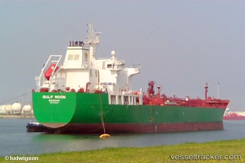
Vessel Gulf Moon IMO: 9335123, MMSI: 309832000 Chemical Oil Products Tanker
UTC, 31.21747, 29.68975, course: 335, speed: 0.1
UTC, 31.22230, 29.69080, course: 319, speed: 0.2
2026-02-21 03:44:20 UTC, 31.22052, 29.68885, course: 311, speed: 0
Live AIS position:
UTC. Near EL DEKHEILA),
updated 2026-02-21 03:44:20 UTC.
Find the position of the vessel Gulf Moon on the map. The latter are known coordinates and path.
marine traffic ship tracker show on live map
The current position of vessel Gulf Moon is 31.22052 lat / 29.68885 lng. Updated: 2026-02-21 03:44:20 UTCCurrently sailing under the flag of Bahamas
Gulf Moon built in 2007 year
Deadweight:
37488 tDetails:
Last coordinates of the vessel:
UTC, 31.22025, 29.68873, course: 8, speed: 0.1UTC, 31.21747, 29.68975, course: 335, speed: 0.1
UTC, 31.22230, 29.69080, course: 319, speed: 0.2
2026-02-21 03:44:20 UTC, 31.22052, 29.68885, course: 311, speed: 0