 vesseltracker.com
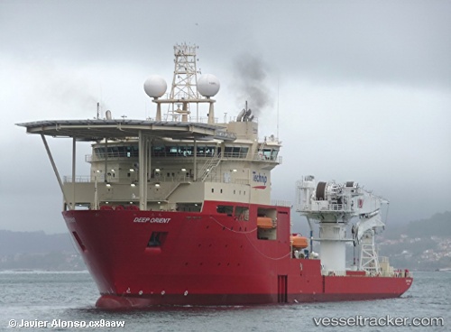
 DEEP ORIENT
Current Status
Where is the vessel?
DEEP ORIENT is currently in Near Prelude, based on AIS data received less than 1h ago.
Latest AIS update:
Current position: 13.78333° S, 123.31667° E (Near Prelude)
Average speed (last 7 days): Loading…
Average speed (last 30 days): Loading…
Vessel profile: DEEP ORIENT is a Offshore Support Vessel with dimensions m x m.
This page combines live AIS, route history, probable destination signals, nearby traffic, and port activity for practical vessel monitoring.
The current position of vessel DEEP ORIENT is -13.78333 lat / 123.31667 lng. Updated: 2026-04-14 17:21:38 UTCNearest reference points:
- Near Prelude
- 65 nm E of Front Puffin FPSO
- 23 nm E of Yampi Sound
Currently sailing under the flag of Bahamas ![]()
DEEP ORIENT built in 2013 year
Deadweight:
8900 tDetails:
Live Vessel DEEP ORIENT Analytics (details, animations, etc.)
Recent AIS points (UTC):
2026-04-14 11:17:41 UTC · -13.78500, 123.31667 · SOG 0 kn · COG -1°2026-04-14 13:45:06 UTC · -13.78333, 123.31667 · SOG 0 kn · COG -1°
2026-04-14 16:00:28 UTC · -13.78333, 123.31667 · SOG 0 kn · COG -1°
2026-04-14 17:21:38 UTC · -13.78333, 123.31667 · SOG 0 kn · COG -1°