 vesseltracker.com
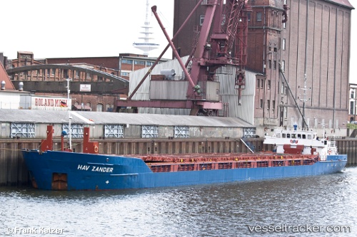
Hav Zander
Current StatusWhere is the vessel?
Hav Zander is currently in 10 nm NW of Noirmoutier-en-l'Île, based on AIS data received about 1h ago.
Latest AIS update:
Current position: 47.06930° N, 2.45689° W (10 nm NW of Noirmoutier-en-l'Île)
Average speed (last 7 days): Loading…
Average speed (last 30 days): Loading…
Vessel profile: Hav Zander is a Multi Purpose Carrier with dimensions 12m x 88m.
This page combines live AIS, route history, probable destination signals, nearby traffic, and port activity for practical vessel monitoring.
The current position of vessel Hav Zander is 47.06930 lat / -2.45689 lng. Updated: 2026-04-07 21:23:39 UTCNearest reference points:
- 12 nm S of Saint-Céols
- 13 nm S of Saint-Céols
- Near LE CROISIC
Details:
Live Vessel Hav Zander Analytics (details, animations, etc.)
Recent AIS points (UTC):
2026-04-07 15:24:53 UTC · 46.41500, -3.18167 · SOG 8 kn · COG -1°2026-04-07 17:46:30 UTC · 46.69874, -2.93238 · SOG 8.4 kn · COG 32°
2026-04-07 20:13:30 UTC · 46.98897, -2.66160 · SOG 8.4 kn · COG 59°
2026-04-07 21:23:39 UTC · 47.06930, -2.45689 · SOG 7.8 kn · COG 43°