 vesseltracker.com
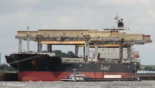
 Jacamar Arrow
Current Status
Where is the vessel?
Jacamar Arrow is currently in Near San Juan de Nieva, based on AIS data received about 1h ago.
Latest AIS update:
Current position: 43.57472° N, 5.91998° W (Near San Juan de Nieva)
Average speed (last 7 days): Loading…
Average speed (last 30 days): Loading…
Vessel profile: Jacamar Arrow is a General Cargo Ship with dimensions 199m x 30m.
This page combines live AIS, route history, probable destination signals, nearby traffic, and port activity for practical vessel monitoring.
The current position of vessel Jacamar Arrow is 43.57472 lat / -5.91998 lng. Updated: 2026-04-07 17:44:58 UTCNearest reference points:
- Near San Juan de Nieva
- Near Musel-Arnao
- Near Tremanes
Currently sailing under the flag of Bahamas ![]()
Jacamar Arrow built in 1992 year
Deadweight:
46998 tDetails:
Live Vessel Jacamar Arrow Analytics (details, animations, etc.)
Recent AIS points (UTC):
2026-04-07 11:41:54 UTC · 43.57472, -5.91997 · SOG 0 kn · COG 355°2026-04-07 13:20:53 UTC · 43.57472, -5.91998 · SOG 0 kn · COG 355°
2026-04-07 15:23:55 UTC · 43.57472, -5.91998 · SOG 0 kn · COG 355°
2026-04-07 17:44:58 UTC · 43.57472, -5.91998 · SOG 0 kn · COG 355°