 vesseltracker.com
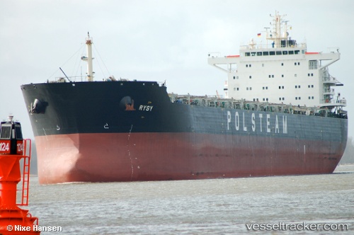
Find the position of the vessel Rysy on the map. The latter are known coordinates and path.
marine traffic ship tracker show on live map
The current position of vessel Rysy is 34.74807 lat / 127.77836 lng. Updated: 2025-10-30 01:50:38 UTCCurrently sailing under the flag of Bahamas
Rysy built in 2011 year
Deadweight:
79602 tDetails:
Last coordinates of the vessel:
UTC, 34.74807, 127.77836, course: 11, speed: 0UTC, 34.74807, 127.77836, course: 11, speed: 0
UTC, 34.74807, 127.77836, course: 11, speed: 0
2025-10-30 01:50:38 UTC, 34.74807, 127.77836, course: 11, speed: 0