 vesseltracker.com
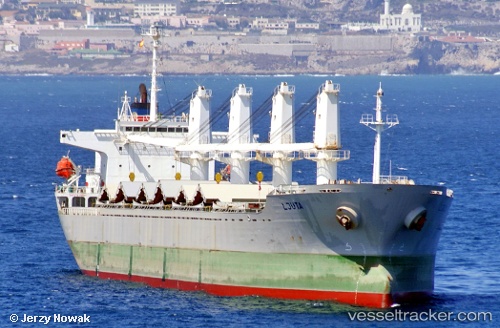
 TRUE BROTHER
Current Status
Where is the vessel?
TRUE BROTHER is currently in Near Oran, based on AIS data received about 2h ago.
Latest AIS update:
Current position: 35.70933° N, 0.64867° W (Near Oran)
Average speed (last 7 days): Loading…
Average speed (last 30 days): Loading…
Vessel profile: TRUE BROTHER is a Bulk Carrier with dimensions 29m x 177m.
This page combines live AIS, route history, probable destination signals, nearby traffic, and port activity for practical vessel monitoring.
The current position of vessel TRUE BROTHER is 35.70933 lat / -0.64867 lng. Updated: 2026-04-04 23:37:19 UTCNearest reference points:
- Near Oran
- Near Arzew
- 30 nm N of Mers El Kebir
Currently sailing under the flag of Barbados ![]()
TRUE BROTHER built in 2001 year
Deadweight:
31812 tDetails:
Live Vessel TRUE BROTHER Analytics (details, animations, etc.)
Recent AIS points (UTC):
2026-04-04 17:49:20 UTC · 35.70933, -0.64833 · SOG 0 kn · COG 261°2026-04-04 19:34:17 UTC · 35.70933, -0.64850 · SOG 0 kn · COG 261°
2026-04-04 21:58:17 UTC · 35.70933, -0.64850 · SOG 0 kn · COG 261°
2026-04-04 23:37:19 UTC · 35.70933, -0.64867 · SOG 0 kn · COG 261°