 vesseltracker.com
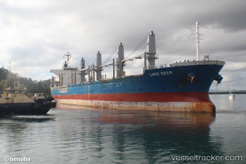
 NORD WIND
Current Status
Where is the vessel?
NORD WIND is currently in Near Casablanca, based on AIS data received less than 1h ago.
Latest AIS update:
Current position: 33.71774° N, 7.67553° W (Near Casablanca)
Average speed (last 7 days): Loading…
Average speed (last 30 days): Loading…
Vessel profile: NORD WIND is a Bulk Carrier with dimensions 169m x 27m.
This page combines live AIS, route history, probable destination signals, nearby traffic, and port activity for practical vessel monitoring.
The current position of vessel NORD WIND is 33.71774 lat / -7.67553 lng. Updated: 2026-04-08 17:44:25 UTCNearest reference points:
- Near Mohammedia
- 54 nm N of El Jadida
- Near Jorf Lasfar
Currently sailing under the flag of Barbados ![]()
NORD WIND built in 2011 year
Deadweight:
28225 tDetails:
Live Vessel NORD WIND Analytics (details, animations, etc.)
Recent AIS points (UTC):
2026-04-08 11:47:19 UTC · 33.71778, -7.67539 · SOG 0.3 kn · COG 284°2026-04-08 14:12:50 UTC · 33.71667, -7.67500 · SOG 0 kn · COG -1°
2026-04-08 16:08:20 UTC · 33.71798, -7.67544 · SOG 0.6 kn · COG 273°
2026-04-08 17:44:25 UTC · 33.71774, -7.67553 · SOG 0.8 kn · COG 280°