 vesseltracker.com
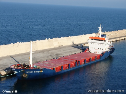
Vessel NECATI CAVUSOGLU IMO: 9212785, MMSI: 314640000 General Cargo Ship
UTC, 42.05462, 33.02457, course: 268, speed: 9
UTC, 42.06051, 32.72930, course: 269, speed: 9
2026-01-28 14:19:36 UTC, 42.05840, 32.18796, course: 269, speed: 9
Live AIS position:
UTC. 23 nm N of Bartin),
updated 2026-01-28 14:19:36 UTC.
Find the position of the vessel NECATI CAVUSOGLU on the map. The latter are known coordinates and path.
marine traffic ship tracker show on live map
The current position of vessel NECATI CAVUSOGLU is 42.05840 lat / 32.18796 lng. Updated: 2026-01-28 14:19:36 UTCCurrently sailing under the flag of Barbados
NECATI CAVUSOGLU built in 1999 year
Deadweight:
3171 tDetails:
Last coordinates of the vessel:
UTC, 41.98016, 33.77453, course: 72, speed: 0UTC, 42.05462, 33.02457, course: 268, speed: 9
UTC, 42.06051, 32.72930, course: 269, speed: 9
2026-01-28 14:19:36 UTC, 42.05840, 32.18796, course: 269, speed: 9