 vesseltracker.com
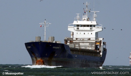
 SAVA
SAVA
Current Status
Where is the vessel?
SAVA is currently in Near San Juan de Nieva, based on AIS data received about 1h ago.
Latest AIS update:
Current position: 43.60889° N, 5.95756° W (Near San Juan de Nieva)
Average speed (last 7 days): Loading…
Average speed (last 30 days): Loading…
Vessel profile: SAVA is a General Cargo Ship with dimensions 122m x 14m.
This page combines live AIS, route history, probable destination signals, nearby traffic, and port activity for practical vessel monitoring.
The current position of vessel SAVA is 43.60889 lat / -5.95756 lng. Updated: 2026-03-31 06:02:17 UTCNearest reference points:
- Near San Juan de Nieva
- Near Musel-Arnao
- Near Tremanes
Currently sailing under the flag of Barbados ![]()
SAVA built in 1999 year
Deadweight:
8300 tDetails:
Live Vessel SAVA Analytics (details, animations, etc.)
Recent AIS points (UTC):
2026-03-30 23:50:27 UTC · 43.60864, -5.95829 · SOG 1 kn · COG 12°2026-03-31 02:17:24 UTC · 43.60964, -5.96013 · SOG 0.7 kn · COG 89°
2026-03-31 03:23:26 UTC · 43.60859, -5.95860 · SOG 0.3 kn · COG 358°
2026-03-31 06:02:17 UTC · 43.60889, -5.95756 · SOG 0.3 kn · COG 313°