 vesseltracker.com
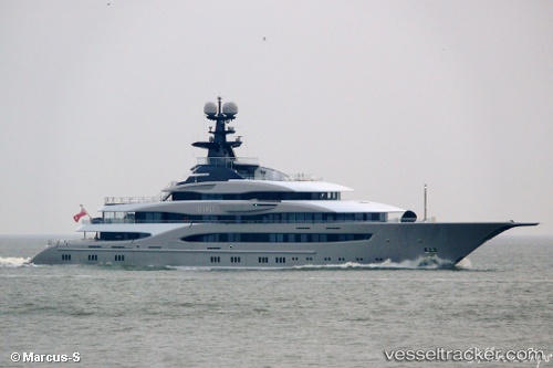
Vessel Kismet IMO: 1012000, MMSI: 319069900 Service Ship
UTC, 18.33491, -64.92059, course: 71, speed: 0
UTC, 18.33489, -64.92056, course: 71, speed: 0
2026-01-29 04:10:24 UTC, 18.33488, -64.92058, course: 71, speed: 0
Live AIS position:
UTC. Near ST THOMAS),
updated 2026-01-29 04:10:24 UTC.
Find the position of the vessel Kismet on the map. The latter are known coordinates and path.
marine traffic ship tracker show on live map
The current position of vessel Kismet is 18.33488 lat / -64.92058 lng. Updated: 2026-01-29 04:10:24 UTCDetails:
Last coordinates of the vessel:
UTC, 18.33490, -64.92060, course: 71, speed: 0UTC, 18.33491, -64.92059, course: 71, speed: 0
UTC, 18.33489, -64.92056, course: 71, speed: 0
2026-01-29 04:10:24 UTC, 18.33488, -64.92058, course: 71, speed: 0