 vesseltracker.com
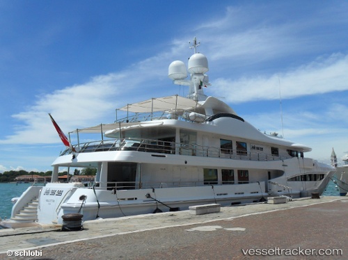
Vessel Lady Nag Nag IMO: 1009742, MMSI: 319084500 Service Ship
UTC, 43.54420, 10.29669, course: 65, speed: 0
UTC, 43.54419, 10.29669, course: 65, speed: 0
2026-01-16 10:14:21 UTC, 43.54418, 10.29669, course: 65, speed: 0
Live AIS position:
UTC. Near Livorno),
updated 2026-01-16 10:14:21 UTC.
Find the position of the vessel Lady Nag Nag on the map. The latter are known coordinates and path.
marine traffic ship tracker show on live map
The current position of vessel Lady Nag Nag is 43.54418 lat / 10.29669 lng. Updated: 2026-01-16 10:14:21 UTCCurrently sailing under the flag of Cayman Is
Lady Nag Nag built in 2008 year
Deadweight:
183 tDetails:
Last coordinates of the vessel:
UTC, 43.54420, 10.29670, course: 65, speed: 0UTC, 43.54420, 10.29669, course: 65, speed: 0
UTC, 43.54419, 10.29669, course: 65, speed: 0
2026-01-16 10:14:21 UTC, 43.54418, 10.29669, course: 65, speed: 0