 vesseltracker.com
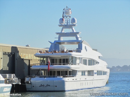
 Lucky Lady
Current Status
Where is the vessel?
Lucky Lady is currently in Near Rivera Beach, based on AIS data received less than 1h ago.
Latest AIS update:
Current position: 26.77109° N, 80.05123° W (Near Rivera Beach)
Average speed (last 7 days): Loading…
Average speed (last 30 days): Loading…
Vessel profile: Lucky Lady is a Service Ship with dimensions 63m x 62m.
This page combines live AIS, route history, probable destination signals, nearby traffic, and port activity for practical vessel monitoring.
The current position of vessel Lucky Lady is 26.77109 lat / -80.05123 lng. Updated: 2026-04-09 10:04:03 UTCNearest reference points:
- Near Palm Beach
- Near Rivera Beach
- Near Lake Park
Currently sailing under the flag of Cayman Is ![]()
Lucky Lady built in 2002 year
Details:
Live Vessel Lucky Lady Analytics (details, animations, etc.)
Recent AIS points (UTC):
2026-04-09 03:46:02 UTC · 26.77109, -80.05122 · SOG 0.1 kn · COG 183°2026-04-09 05:22:03 UTC · 26.77103, -80.05127 · SOG 0 kn · COG 182°
2026-04-09 07:48:54 UTC · 26.77107, -80.05124 · SOG 0 kn · COG 183°
2026-04-09 10:04:03 UTC · 26.77109, -80.05123 · SOG 0 kn · COG 183°