 vesseltracker.com
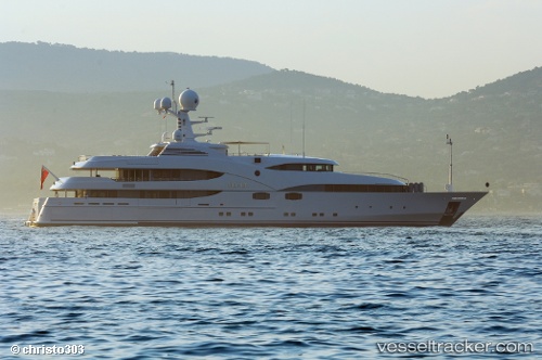
Nourah Of Riyad
Current StatusWhere is the vessel?
Nourah Of Riyad is currently in Near Cannes, based on AIS data received less than 1h ago.
Latest AIS update:
Current position: 43.53952° N, 7.03129° E (Near Cannes)
Average speed (last 7 days): Loading…
Average speed (last 30 days): Loading…
Vessel profile: Nourah Of Riyad is a Service Ship with dimensions 11m x 70m.
This page combines live AIS, route history, probable destination signals, nearby traffic, and port activity for practical vessel monitoring.
The current position of vessel Nourah Of Riyad is 43.53952 lat / 7.03129 lng. Updated: 2026-04-19 16:23:16 UTCNearest reference points:
- Near GOLFE JUAN
- Near Juan-les-Pins
- Near Golfe-Juan
Details:
Live Vessel Nourah Of Riyad Analytics (details, animations, etc.)
Recent AIS points (UTC):
2026-04-19 12:23:19 UTC · 43.53952, 7.03130 · SOG 0 kn · COG 26°2026-04-19 13:56:20 UTC · 43.53952, 7.03128 · SOG 0 kn · COG 27°
2026-04-19 13:59:21 UTC · 43.53954, 7.03129 · SOG 0 kn · COG 26°
2026-04-19 16:23:16 UTC · 43.53952, 7.03129 · SOG 0 kn · COG 27°