 vesseltracker.com
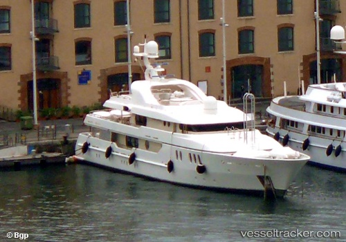
Vessel MONALIZA IMO: 9097616, MMSI: 325116500 Houseboat
UTC, 36.74922, 28.94216, course: -1, speed: 0
UTC, 36.74922, 28.94216, course: -1, speed: 0
2026-02-22 12:01:26 UTC, 36.74922, 28.94216, course: -1, speed: 0
Live AIS position:
UTC. Near GOCEK),
updated 2026-02-22 12:01:26 UTC.
Find the position of the vessel MONALIZA on the map. The latter are known coordinates and path.
marine traffic ship tracker show on live map
The current position of vessel MONALIZA is 36.74922 lat / 28.94216 lng. Updated: 2026-02-22 12:01:26 UTCCurrently sailing under the flag of Dominica
MONALIZA built in 2001 year
Deadweight:
0 tDetails:
Last coordinates of the vessel:
UTC, 36.67863, 28.90430, course: 10, speed: 11.3UTC, 36.74922, 28.94216, course: -1, speed: 0
UTC, 36.74922, 28.94216, course: -1, speed: 0
2026-02-22 12:01:26 UTC, 36.74922, 28.94216, course: -1, speed: 0