 vesseltracker.com
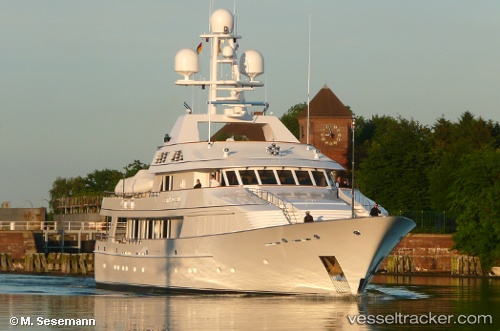
 Maria
Maria
Current Status
Where is the vessel?
Maria is currently in Near FLISVOS, based on AIS data received less than 1h ago.
Latest AIS update:
Current position: 37.93083° N, 23.68319° E (Near FLISVOS)
Average speed (last 7 days): Loading…
Average speed (last 30 days): Loading…
Vessel profile: Maria is a Service Ship with dimensions 50m x 50m.
This page combines live AIS, route history, probable destination signals, nearby traffic, and port activity for practical vessel monitoring.
The current position of vessel Maria is 37.93083 lat / 23.68319 lng. Updated: 2026-04-17 02:42:05 UTCNearest reference points:
- Near FLISVOS
- Near ZEA
- Near ALIMOS
Currently sailing under the flag of Jamaica ![]()
Maria built in 1996 year
Deadweight:
625 tDetails:
Live Vessel Maria Analytics (details, animations, etc.)
Recent AIS points (UTC):
2026-04-16 19:51:46 UTC · 37.93075, 23.68323 · SOG 0 kn · COG 212°2026-04-16 22:22:05 UTC · 37.93082, 23.68318 · SOG 0 kn · COG 212°
2026-04-17 00:18:04 UTC · 37.93089, 23.68318 · SOG 0 kn · COG 212°
2026-04-17 02:42:05 UTC · 37.93083, 23.68319 · SOG 0 kn · COG 212°