 vesseltracker.com
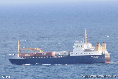
Duke Of Topsail
Current StatusWhere is the vessel?
Duke Of Topsail is currently in Near MARSH HARBOR, based on AIS data received about 6h ago.
Latest AIS update:
Current position: 26.54305° N, 77.06501° W (Near MARSH HARBOR)
Average speed (last 7 days): Loading…
Average speed (last 30 days): Loading…
Vessel profile: Duke Of Topsail is a Ro Ro Cargo Ship with dimensions 14m x 72m.
This page combines live AIS, route history, probable destination signals, nearby traffic, and port activity for practical vessel monitoring.
The current position of vessel Duke Of Topsail is 26.54305 lat / -77.06501 lng. Updated: 2026-04-10 07:47:35 UTCNearest reference points:
- Near Green Turtle Cay
- 27 nm SE of Gorda Cay
- Near Harbour Island
Details:
Live Vessel Duke Of Topsail Analytics (details, animations, etc.)
Recent AIS points (UTC):
2026-04-10 02:17:35 UTC · 26.54307, -77.06500 · SOG 0 kn · COG 2°2026-04-10 04:15:10 UTC · 26.54167, -77.06333 · SOG 0 kn · COG -1°
2026-04-10 06:26:34 UTC · 26.54306, -77.06499 · SOG 0 kn · COG 2°
2026-04-10 07:47:35 UTC · 26.54305, -77.06501 · SOG 0 kn · COG 2°