 vesseltracker.com
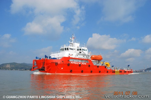
 MEO GALAXY
Current Status
Where is the vessel?
MEO GALAXY is currently in 44 nm S of Soroosh (Cyrus) Terminal, based on AIS data received about 1d ago.
Latest AIS update:
Current position: 28.30502° N, 49.57693° E (44 nm S of Soroosh (Cyrus) Terminal)
Average speed (last 7 days): Loading…
Average speed (last 30 days): Loading…
Vessel profile: MEO GALAXY is a Utility Vessel with dimensions 20m x 70m.
This page combines live AIS, route history, probable destination signals, nearby traffic, and port activity for practical vessel monitoring.
The current position of vessel MEO GALAXY is 28.30502 lat / 49.57693 lng. Updated: 2026-04-10 07:23:08 UTCNearest reference points:
- 41 nm S of Soroosh (Cyrus) Terminal
- 38 nm S of Soroosh (Cyrus) Terminal
- 41 nm NE of Ras Al Khair
Currently sailing under the flag of Panama ![]()
MEO GALAXY built in 2011 year
Deadweight:
1500 tDetails:
Live Vessel MEO GALAXY Analytics (details, animations, etc.)
Recent AIS points (UTC):
2026-04-10 02:26:02 UTC · 28.30497, 49.57561 · SOG 0.9 kn · COG 268°2026-04-10 03:59:05 UTC · 28.30504, 49.57694 · SOG 0 kn · COG 242°
2026-04-10 06:14:05 UTC · 28.30507, 49.57693 · SOG 0 kn · COG 242°
2026-04-10 07:23:08 UTC · 28.30502, 49.57693 · SOG 0.1 kn · COG 242°