 vesseltracker.com
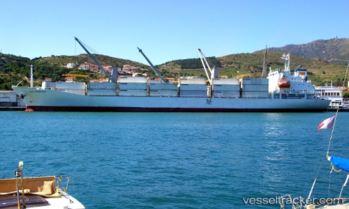
Lady Rosebud
Current StatusWhere is the vessel?
Lady Rosebud is currently in 292 nm NE of Kitadaito Apt, based on AIS data received about 1h ago.
Latest AIS update:
Current position: 28.07477° N, 136.21033° E (292 nm NE of Kitadaito Apt)
Average speed (last 7 days): Loading…
Average speed (last 30 days): Loading…
Vessel profile: Lady Rosebud is a Refrigerated Cargo Ship with dimensions 23m x 143m.
This page combines live AIS, route history, probable destination signals, nearby traffic, and port activity for practical vessel monitoring.
The current position of vessel Lady Rosebud is 28.07477 lat / 136.21033 lng. Updated: 2026-04-08 11:57:14 UTCNearest reference points:
- 190 nm E of NISHINOOMOTE
Details:
Live Vessel Lady Rosebud Analytics (details, animations, etc.)
Recent AIS points (UTC):
2026-04-08 04:16:51 UTC · 26.08730, 135.23170 · SOG 18.4 kn · COG 29°2026-04-08 06:18:39 UTC · 26.64495, 135.50833 · SOG 17 kn · COG 25°
2026-04-08 09:33:57 UTC · 27.47053, 135.94185 · SOG 17 kn · COG 19°
2026-04-08 11:57:14 UTC · 28.07477, 136.21033 · SOG 16.2 kn · COG 17°