 vesseltracker.com
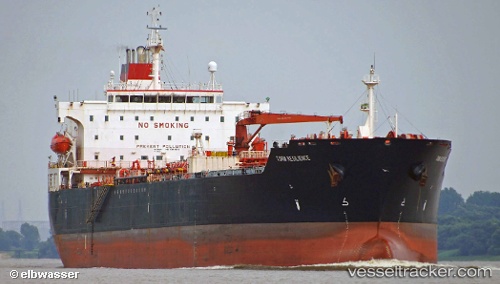
 PEACE GULF
Current Status
Where is the vessel?
PEACE GULF is currently in Near Offshore Fujairah, based on AIS data received about 2d ago.
Latest AIS update:
Current position: 25.28891° N, 56.54149° E (Near Offshore Fujairah)
Average speed (last 7 days): Loading…
Average speed (last 30 days): Loading…
Vessel profile: PEACE GULF is a Oil Products Tanker with dimensions m x m.
This page combines live AIS, route history, probable destination signals, nearby traffic, and port activity for practical vessel monitoring.
The current position of vessel PEACE GULF is 25.28891 lat / 56.54149 lng. Updated: 2026-03-26 09:04:12 UTCNearest reference points:
- Near Fujairah
- Near KHORFAKKAN
- Near Offshore Fujairah
Currently sailing under the flag of Panama ![]()
Details:
Live Vessel PEACE GULF Analytics (details, animations, etc.)
Recent AIS points (UTC):
2026-03-26 08:19:39 UTC · 25.28891, 56.54149 · SOG 0 kn · COG 69°2026-03-26 09:04:12 UTC · 25.28891, 56.54149 · SOG 0 kn · COG -1°
2026-03-26 09:04:12 UTC · 25.28891, 56.54149 · SOG 0 kn · COG -1°
2026-03-26 09:04:12 UTC · 25.28891, 56.54149 · SOG 0 kn · COG -1°