 vesseltracker.com
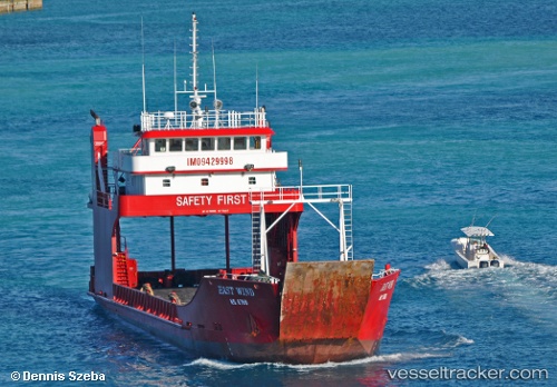
East Wind
Current StatusWhere is the vessel?
East Wind is currently in 39 nm W of Little Stirrup Cay, based on AIS data received about 4h ago.
Latest AIS update:
Current position: 25.73896° N, 78.65053° W (39 nm W of Little Stirrup Cay)
Average speed (last 7 days): Loading…
Average speed (last 30 days): Loading…
Vessel profile: East Wind is a Ro Ro Cargo Ship with dimensions 11m x 54m.
This page combines live AIS, route history, probable destination signals, nearby traffic, and port activity for practical vessel monitoring.
The current position of vessel East Wind is 25.73896 lat / -78.65053 lng. Updated: 2026-04-05 06:27:18 UTCNearest reference points:
- 44 nm S of Freeport
- 44 nm E of Surfside
- Near Lyford Cay
Details:
Live Vessel East Wind Analytics (details, animations, etc.)
Recent AIS points (UTC):
2026-04-05 03:35:51 UTC · 25.93887, -78.97473 · SOG 7.1 kn · COG -1°2026-04-05 06:10:28 UTC · 25.75960, -78.68178 · SOG 7.5 kn · COG -1°
2026-04-05 06:27:18 UTC · 25.73896, -78.65053 · SOG 7.6 kn · COG -1°
2026-04-05 06:27:18 UTC · 25.73896, -78.65053 · SOG 7.6 kn · COG -1°