 vesseltracker.com
 VM LEGEND
Current Status
Where is the vessel?
VM LEGEND is currently in 26 nm E of Bandar Al Mishab, based on AIS data received about 1h ago.
Latest AIS update:
Current position: 28.21175° N, 49.20489° E (26 nm E of Bandar Al Mishab)
Average speed (last 7 days): Loading…
Average speed (last 30 days): Loading…
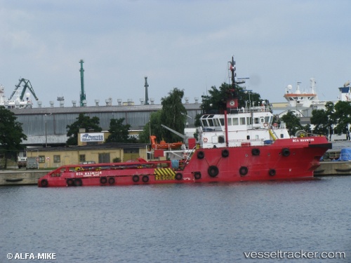
Vessel profile: VM LEGEND is a Offshore Tug/Supply Ship with dimensions 13m x 48m.
This page combines live AIS, route history, probable destination signals, nearby traffic, and port activity for practical vessel monitoring.
The current position of vessel VM LEGEND is 28.21175 lat / 49.20489 lng. Updated: 2026-04-08 11:51:37 UTCNearest reference points:
- 26 nm E of Bandar Al Mishab
- 29 nm E of Bandar Al Mishab
- 31 nm S of Soroosh (Cyrus) Terminal
Currently sailing under the flag of Panama ![]()
VM LEGEND built in 2006 year
Deadweight:
770 tDetails:
Live Vessel VM LEGEND Analytics (details, animations, etc.)
Recent AIS points (UTC):
2026-04-08 06:21:28 UTC · 28.20831, 49.19358 · SOG 0.2 kn · COG 200°2026-04-08 07:41:36 UTC · 28.21776, 49.19437 · SOG 0.4 kn · COG 251°
2026-04-08 09:51:06 UTC · 28.22537, 49.19350 · SOG 0.2 kn · COG 178°
2026-04-08 11:51:37 UTC · 28.21175, 49.20489 · SOG 0.3 kn · COG 286°