 vesseltracker.com
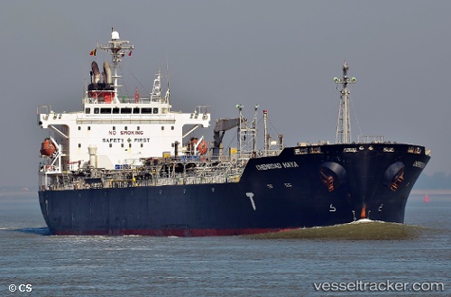
Chemroad Haya
Current StatusWhere is the vessel?
Chemroad Haya is currently in 62 nm W of Abakaliki, based on AIS data received about 1h ago.
Latest AIS update:
Current position: 5.96080° N, 85.03325° E (62 nm W of Abakaliki)
Average speed (last 7 days): Loading…
Average speed (last 30 days): Loading…
Vessel profile: Chemroad Haya is a Chemical Oil Products Tanker with dimensions 29m x 175m.
This page combines live AIS, route history, probable destination signals, nearby traffic, and port activity for practical vessel monitoring.
The current position of vessel Chemroad Haya is 5.96080 lat / 85.03325 lng. Updated: 2026-04-17 02:03:50 UTCNearest reference points:
- 46 nm SW of Abakaliki
- 23 nm S of Abakaliki
- 127 nm W of Abakaliki
Details:
Live Vessel Chemroad Haya Analytics (details, animations, etc.)
Recent AIS points (UTC):
2026-04-16 18:58:17 UTC · 6.01946, 86.63235 · SOG 13.7 kn · COG 268°2026-04-16 21:00:28 UTC · 6.01528, 86.17467 · SOG 13 kn · COG 268°
2026-04-16 23:13:54 UTC · 5.98576, 85.68525 · SOG 13.4 kn · COG 266°
2026-04-17 02:03:50 UTC · 5.96080, 85.03325 · SOG 13.9 kn · COG 266°