 vesseltracker.com
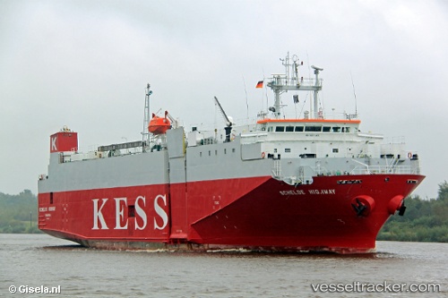
Vessel Schelde Highway IMO: 9065405, MMSI: 355444000 Vehicles Carrier
UTC, 54.14586, 12.10469, course: 351, speed: 0
UTC, 54.14587, 12.10469, course: 351, speed: 0
2026-01-15 13:58:41 UTC, 54.39589, 12.15533, course: 38, speed: 12.8
Live AIS position:
UTC. Near Graal-Müritz),
updated 2026-01-15 13:58:41 UTC.
Find the position of the vessel Schelde Highway on the map. The latter are known coordinates and path.
marine traffic ship tracker show on live map
The current position of vessel Schelde Highway is 54.39589 lat / 12.15533 lng. Updated: 2026-01-15 13:58:41 UTCCurrently sailing under the flag of Panama
Schelde Highway built in 1993 year
Deadweight:
3222 tDetails:
Last coordinates of the vessel:
UTC, 54.14585, 12.10468, course: 351, speed: 0UTC, 54.14586, 12.10469, course: 351, speed: 0
UTC, 54.14587, 12.10469, course: 351, speed: 0
2026-01-15 13:58:41 UTC, 54.39589, 12.15533, course: 38, speed: 12.8