 vesseltracker.com
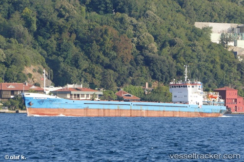
Vessel UST ORDA IMO: 8866682, MMSI: 356245000 General Cargo Ship
UTC, 38.85135, 26.89765, course: -1, speed: 0
UTC, 38.85135, 26.89765, course: -1, speed: 0
2026-02-27 08:30:36 UTC, 38.85135, 26.89765, course: -1, speed: 0
Live AIS position:
UTC. Near Aliaga),
updated 2026-02-27 08:30:36 UTC.
Find the position of the vessel UST ORDA on the map. The latter are known coordinates and path.
marine traffic ship tracker show on live map
The current position of vessel UST ORDA is 38.85135 lat / 26.89765 lng. Updated: 2026-02-27 08:30:36 UTCCurrently sailing under the flag of Panama
UST ORDA built in 1977 year
Deadweight:
3174 tDetails:
Last coordinates of the vessel:
UTC, 38.85136, 26.89761, course: -1, speed: 0UTC, 38.85135, 26.89765, course: -1, speed: 0
UTC, 38.85135, 26.89765, course: -1, speed: 0
2026-02-27 08:30:36 UTC, 38.85135, 26.89765, course: -1, speed: 0