 vesseltracker.com
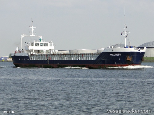
Vessel Victress IMO: 9030498, MMSI: 357544000 General Cargo Ship
UTC, 42.54744, 30.78600, course: -1, speed: 8.8
UTC, 41.26404, 31.38978, course: -1, speed: 0
2026-03-02 20:06:27 UTC, 41.26404, 31.38978, course: -1, speed: 0
Live Vessel Victress Analytics (details, animations, etc.)
Live AIS position: UTC. Near Erdemir), updated 2026-03-02 20:06:27 UTC.Find the position of the vessel Victress on the map. The latter are known coordinates and path.
marine traffic ship tracker show on live map
The current position of vessel Victress is 41.26404 lat / 31.38978 lng. Updated: 2026-03-02 20:06:27 UTCCurrently sailing under the flag of Panama
Victress built in 1992 year
Deadweight:
2386 tDetails:
Last coordinates of the vessel:
UTC, 42.54744, 30.78600, course: -1, speed: 8.8UTC, 42.54744, 30.78600, course: -1, speed: 8.8
UTC, 41.26404, 31.38978, course: -1, speed: 0
2026-03-02 20:06:27 UTC, 41.26404, 31.38978, course: -1, speed: 0