 vesseltracker.com
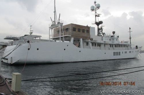
Vessel Hayama IMO: 8810231, MMSI: 357878000 Fishing Vessel
UTC, 27.38069, 33.68917, course: 349, speed: 0
UTC, 27.38069, 33.68917, course: 349, speed: 0
2026-02-24 20:28:38 UTC, 27.38072, 33.68924, course: -1, speed: 0
Live AIS position:
UTC. Near El-Guna (El Gouna)),
updated 2026-02-24 20:28:38 UTC.
Find the position of the vessel Hayama on the map. The latter are known coordinates and path.
marine traffic ship tracker show on live map
The current position of vessel Hayama is 27.38072 lat / 33.68924 lng. Updated: 2026-02-24 20:28:38 UTCDetails:
Last coordinates of the vessel:
UTC, 27.38069, 33.68917, course: 349, speed: 0UTC, 27.38069, 33.68917, course: 349, speed: 0
UTC, 27.38069, 33.68917, course: 349, speed: 0
2026-02-24 20:28:38 UTC, 27.38072, 33.68924, course: -1, speed: 0