 vesseltracker.com
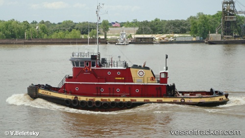
Vessel Jackie B IMO: 9127215, MMSI: 366940000 Tug
UTC, 29.92482, -90.13582, course: -1, speed: 0
UTC, 29.92479, -90.13586, course: -1, speed: 0
2026-03-14 17:28:28 UTC, 29.92482, -90.13586, course: -1, speed: 0
Live Vessel Jackie B Analytics (details, animations, etc.)
Live AIS position: UTC. Near Bridge City), updated 2026-03-14 17:28:28 UTC.Find the position of the vessel Jackie B on the map. The latter are known coordinates and path.
marine traffic ship tracker show on live map
The current position of vessel Jackie B is 29.92482 lat / -90.13586 lng. Updated: 2026-03-14 17:28:28 UTCCurrently sailing under the flag of USA
Jackie B built in 1995 year
Deadweight:
415 tDetails:
Last coordinates of the vessel:
UTC, 29.92479, -90.13582, course: -1, speed: 0UTC, 29.92482, -90.13582, course: -1, speed: 0
UTC, 29.92479, -90.13586, course: -1, speed: 0
2026-03-14 17:28:28 UTC, 29.92482, -90.13586, course: -1, speed: 0