 vesseltracker.com
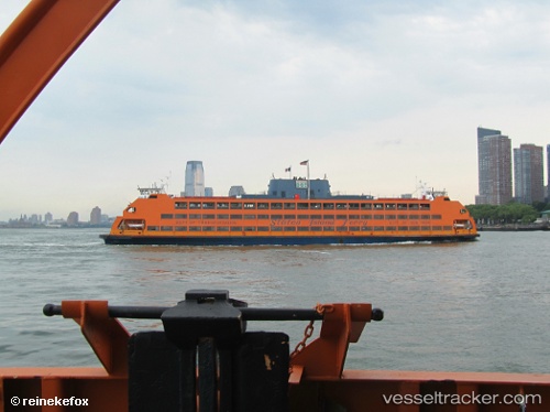
 Samuel I Newhouse
Current Status
Where is the vessel?
Samuel I Newhouse is currently in Near New York, based on AIS data received less than 1h ago.
Latest AIS update:
Current position: 40.69603° N, 74.01860° W (Near New York)
Average speed (last 7 days): Loading…
Average speed (last 30 days): Loading…
Vessel profile: Samuel I Newhouse is a Passenger Ro Ro Cargo Ship with dimensions 95m x 22m.
This page combines live AIS, route history, probable destination signals, nearby traffic, and port activity for practical vessel monitoring.
The current position of vessel Samuel I Newhouse is 40.69603 lat / -74.01860 lng. Updated: 2026-04-08 02:18:56 UTCNearest reference points:
- Near New York
- Near Jersey City
- Near Brooklyn
Currently sailing under the flag of USA ![]()
Samuel I Newhouse built in 1982 year
Deadweight:
2250 tDetails:
Live Vessel Samuel I Newhouse Analytics (details, animations, etc.)
Recent AIS points (UTC):
2026-04-07 19:53:49 UTC · 40.64467, -74.07267 · SOG 0 kn · COG 218°2026-04-07 21:46:18 UTC · 40.65618, -74.05563 · SOG 16.8 kn · COG 17°
2026-04-08 00:15:25 UTC · 40.64467, -74.07250 · SOG 0.1 kn · COG 217°
2026-04-08 02:18:56 UTC · 40.69603, -74.01860 · SOG 15.3 kn · COG 54°