 vesseltracker.com
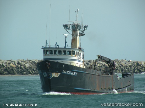
 MCKINLEY
Current Status
Where is the vessel?
MCKINLEY is currently in 74 nm SE of NANTUCKET, based on AIS data received about 2h ago.
Latest AIS update:
Current position: 40.23191° N, 69.24127° W (74 nm SE of NANTUCKET)
Average speed (last 7 days): Loading…
Average speed (last 30 days): Loading…
Vessel profile: MCKINLEY is a Fishing Vessel with dimensions 10m x 32m.
This page combines live AIS, route history, probable destination signals, nearby traffic, and port activity for practical vessel monitoring.
The current position of vessel MCKINLEY is 40.23191 lat / -69.24127 lng. Updated: 2026-03-28 16:33:55 UTCNearest reference points:
- 28 nm SE of East Harwich
- 19 nm S of Chilmark
- 114 nm SE of Offshore Ambrose
Currently sailing under the flag of United States of America ![]()
MCKINLEY built in 1981 year
Deadweight:
0 tDetails:
Live Vessel MCKINLEY Analytics (details, animations, etc.)
Recent AIS points (UTC):
2026-03-28 12:13:51 UTC · 40.22669, -69.16782 · SOG 2.9 kn · COG 62°2026-03-28 12:21:27 UTC · 40.22613, -69.16424 · SOG 1.9 kn · COG 81°
2026-03-28 14:43:54 UTC · 40.19793, -69.20184 · SOG 2.5 kn · COG 4°
2026-03-28 16:33:55 UTC · 40.23191, -69.24127 · SOG 7 kn · COG 217°