 vesseltracker.com
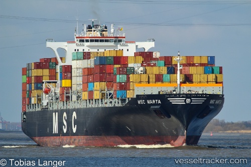
Vessel Msc Marta IMO: 9295385, MMSI: 371474000 Container Ship
UTC, 6.42833, 3.34167, course: -1, speed: 0
UTC, 6.42941, 3.34164, course: 274, speed: 0
2026-01-17 11:32:28 UTC, 6.42941, 3.34171, course: 274, speed: 0
Live AIS position:
UTC. Near Kirikiri),
updated 2026-01-17 11:32:28 UTC.
Find the position of the vessel Msc Marta on the map. The latter are known coordinates and path.
marine traffic ship tracker show on live map
The current position of vessel Msc Marta is 6.42941 lat / 3.34171 lng. Updated: 2026-01-17 11:32:28 UTCCurrently sailing under the flag of Panama
Msc Marta built in 2005 year
Deadweight:
72044 tDetails:
Last coordinates of the vessel:
UTC, 6.42941, 3.34168, course: 273, speed: 0UTC, 6.42833, 3.34167, course: -1, speed: 0
UTC, 6.42941, 3.34164, course: 274, speed: 0
2026-01-17 11:32:28 UTC, 6.42941, 3.34171, course: 274, speed: 0