 vesseltracker.com
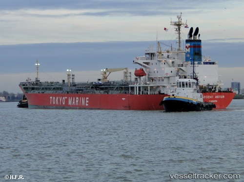
 Argent Aster
Current Status
Where is the vessel?
Argent Aster is currently in 86 nm W of Czarny Bor, based on AIS data received about 1h ago.
Latest AIS update:
Current position: 50.54655° N, 159.10210° E (86 nm W of Czarny Bor)
Average speed (last 7 days): Loading…
Average speed (last 30 days): Loading…
Vessel profile: Argent Aster is a Chemical Oil Products Tanker with dimensions 174m x 28m.
This page combines live AIS, route history, probable destination signals, nearby traffic, and port activity for practical vessel monitoring.
The current position of vessel Argent Aster is 50.54655 lat / 159.10210 lng. Updated: 2026-04-07 12:14:52 UTCNearest reference points:
- 31 nm E of Severo-Kurilsk
- 16 nm SE of Petropavlovsk-Kamchatskiy
- Near Petropavlovsk-Kamchatskiy
Currently sailing under the flag of Panama ![]()
Argent Aster built in 2007 year
Deadweight:
35210 tDetails:
Live Vessel Argent Aster Analytics (details, animations, etc.)
Recent AIS points (UTC):
2026-04-07 05:39:23 UTC · 51.51629, 160.85149 · SOG 13.2 kn · COG 230°2026-04-07 07:35:47 UTC · 51.22063, 160.33337 · SOG 13.5 kn · COG 232°
2026-04-07 09:37:22 UTC · 50.92412, 159.77240 · SOG 13.4 kn · COG 225°
2026-04-07 12:14:52 UTC · 50.54655, 159.10210 · SOG 12.3 kn · COG 219°