 vesseltracker.com
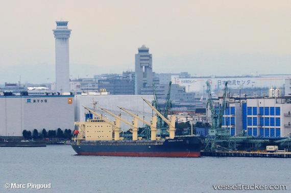
Boracay Island
Current StatusWhere is the vessel?
Boracay Island is currently in Near Vancouver Harbour Water Apt/Vancouver, based on AIS data received less than 1h ago.
Latest AIS update:
Current position: 49.28918° N, 123.07948° W (Near Vancouver Harbour Water Apt/Vancouver)
Average speed (last 7 days): Loading…
Average speed (last 30 days): Loading…
Vessel profile: Boracay Island is a General Cargo Ship with dimensions 31m x 180m.
This page combines live AIS, route history, probable destination signals, nearby traffic, and port activity for practical vessel monitoring.
The current position of vessel Boracay Island is 49.28918 lat / -123.07948 lng. Updated: 2026-04-03 21:43:18 UTCNearest reference points:
- Near North Vancouver
- Near Vancouver
- Near English Bay
Details:
Live Vessel Boracay Island Analytics (details, animations, etc.)
Recent AIS points (UTC):
2026-04-03 15:40:07 UTC · 49.28921, -123.07944 · SOG 0 kn · COG 179°2026-04-03 18:25:14 UTC · 49.28923, -123.07944 · SOG 0 kn · COG 179°
2026-04-03 20:04:09 UTC · 49.28919, -123.07947 · SOG 0 kn · COG 179°
2026-04-03 21:43:18 UTC · 49.28918, -123.07948 · SOG 0 kn · COG 179°