 vesseltracker.com
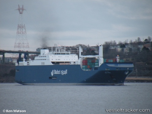
 Bahri Yanbu
Current Status
Where is the vessel?
Bahri Yanbu is currently in Near Bremerhaven-Speckenbüttel, based on AIS data received less than 1h ago.
Latest AIS update:
Current position: 53.57802° N, 8.55085° E (Near Bremerhaven-Speckenbüttel)
Average speed (last 7 days): Loading…
Average speed (last 30 days): Loading…
Vessel profile: Bahri Yanbu is a Ro Ro Cargo Ship with dimensions 225m x 32m.
This page combines live AIS, route history, probable destination signals, nearby traffic, and port activity for practical vessel monitoring.
The current position of vessel Bahri Yanbu is 53.57802 lat / 8.55085 lng. Updated: 2026-04-02 18:18:53 UTCNearest reference points:
- Near Bremerhaven
- Near Sandstedt
- Near Brake
Currently sailing under the flag of Saudi Arabia ![]()
Details:
Live Vessel Bahri Yanbu Analytics (details, animations, etc.)
Recent AIS points (UTC):
2026-04-02 12:00:45 UTC · 53.57803, 8.55085 · SOG 0 kn · COG 185°2026-04-02 13:54:46 UTC · 53.57802, 8.55090 · SOG 0 kn · COG 185°
2026-04-02 15:27:45 UTC · 53.57805, 8.55087 · SOG 0 kn · COG 185°
2026-04-02 18:18:53 UTC · 53.57802, 8.55085 · SOG 0.1 kn · COG 185°