 vesseltracker.com
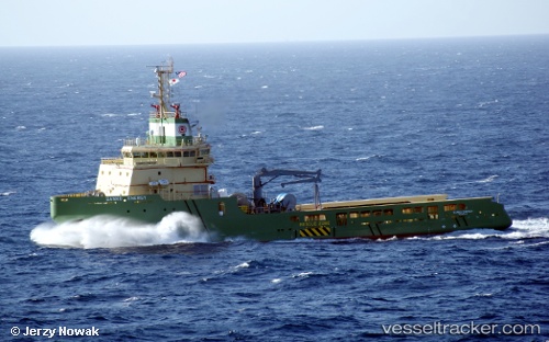
 KAN TAN 222
Current Status
Where is the vessel?
KAN TAN 222 is currently in 28 nm SW of Ledong, based on AIS data received less than 1h ago.
Latest AIS update:
Current position: 18.24663° N, 108.48266° E (28 nm SW of Ledong)
Average speed (last 7 days): Loading…
Average speed (last 30 days): Loading…
Vessel profile: KAN TAN 222 is a Offshore Tug/Supply Ship with dimensions 18m x 65m.
This page combines live AIS, route history, probable destination signals, nearby traffic, and port activity for practical vessel monitoring.
The current position of vessel KAN TAN 222 is 18.24663 lat / 108.48266 lng. Updated: 2026-03-30 08:15:03 UTCNearest reference points:
- 60 nm SW of Ledong
- 19 nm W of San-Ya Chiang
- 19 nm NW of San-Ya Chiang
Currently sailing under the flag of China Peopless Republic ![]()
KAN TAN 222 built in 2011 year
Deadweight:
3170 tDetails:
Live Vessel KAN TAN 222 Analytics (details, animations, etc.)
Recent AIS points (UTC):
2026-03-30 01:30:08 UTC · 18.21495, 108.47143 · SOG 0 kn · COG 18°2026-03-30 04:04:08 UTC · 18.21498, 108.47142 · SOG 0 kn · COG 14°
2026-03-30 05:51:04 UTC · 18.24641, 108.48320 · SOG 0.5 kn · COG 201°
2026-03-30 08:15:03 UTC · 18.24663, 108.48266 · SOG 0.6 kn · COG 128°