 vesseltracker.com
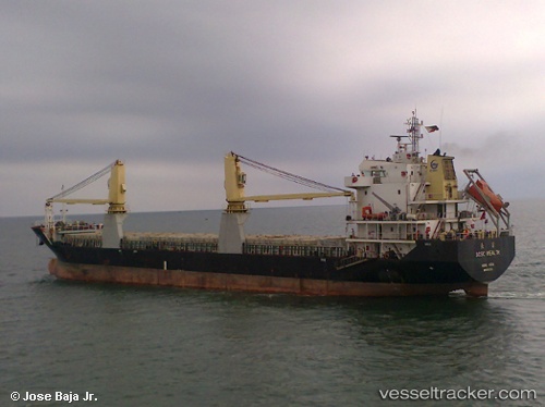
Chang Xiong
Current StatusWhere is the vessel?
Chang Xiong is currently in 141 nm NW of Pulau Lang Lang, based on AIS data received about 1h ago.
Latest AIS update:
Current position: 9.55166° N, 112.89500° E (141 nm NW of Pulau Lang Lang)
Average speed (last 7 days): Loading…
Average speed (last 30 days): Loading…
Vessel profile: Chang Xiong is a General Cargo Ship with dimensions 18m x 117m.
This page combines live AIS, route history, probable destination signals, nearby traffic, and port activity for practical vessel monitoring.
The current position of vessel Chang Xiong is 9.55166 lat / 112.89500 lng. Updated: 2026-04-07 09:45:59 UTCNearest reference points:
- 142 nm N of Pulau Lang Lang
- 141 nm N of Pulau Lang Lang
- 211 nm N of Pulau Lang Lang
Details:
Live Vessel Chang Xiong Analytics (details, animations, etc.)
Recent AIS points (UTC):
2026-04-07 03:58:05 UTC · 9.55166, 112.89500 · SOG 0 kn · COG -1°2026-04-07 05:39:59 UTC · 9.55166, 112.89500 · SOG 0 kn · COG -1°
2026-04-07 07:16:00 UTC · 9.55166, 112.89500 · SOG 0 kn · COG -1°
2026-04-07 09:45:59 UTC · 9.55166, 112.89500 · SOG 0 kn · COG -1°