 vesseltracker.com
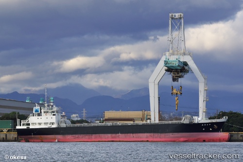
Vessel Tetsuryu Maru IMO: 9572537, MMSI: 431001305 General Cargo Ship
UTC, 35.06941, 136.85901, course: 323, speed: 0
UTC, 35.06947, 136.85902, course: 323, speed: 0
2026-03-24 05:30:25 UTC, 35.06945, 136.85899, course: 323, speed: 0
Live Vessel Tetsuryu Maru Analytics (details, animations, etc.)
Live AIS position: UTC. Near Nagoya), updated 2026-03-24 05:30:25 UTC.Find the position of the vessel Tetsuryu Maru on the map. The latter are known coordinates and path.
marine traffic ship tracker show on live map
The current position of vessel Tetsuryu Maru is 35.06945 lat / 136.85899 lng. Updated: 2026-03-24 05:30:25 UTCDetails:
Last coordinates of the vessel:
UTC, 35.06945, 136.85896, course: 323, speed: 0UTC, 35.06941, 136.85901, course: 323, speed: 0
UTC, 35.06947, 136.85902, course: 323, speed: 0
2026-03-24 05:30:25 UTC, 35.06945, 136.85899, course: 323, speed: 0