 vesseltracker.com
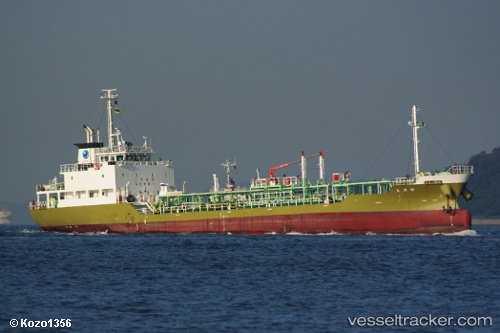
 Shinyo Maru
Current Status
Where is the vessel?
Shinyo Maru is currently in Near Kawasaki, based on AIS data received about 1h ago.
Latest AIS update:
Current position: 35.51290° N, 139.84253° E (Near Kawasaki)
Average speed (last 7 days): Loading…
Average speed (last 30 days): Loading…
Vessel profile: Shinyo Maru is a Chemical Oil Products Tanker with dimensions 72m x 11m.
This page combines live AIS, route history, probable destination signals, nearby traffic, and port activity for practical vessel monitoring.
The current position of vessel Shinyo Maru is 35.51290 lat / 139.84253 lng. Updated: 2026-04-15 23:19:54 UTCNearest reference points:
- Near Aomi
- Near Kawasaki
- Near ANEGASAKI
Currently sailing under the flag of Japan ![]()
Details:
Live Vessel Shinyo Maru Analytics (details, animations, etc.)
Recent AIS points (UTC):
2026-04-15 18:05:13 UTC · 35.50323, 139.75539 · SOG 0 kn · COG 61°2026-04-15 20:20:12 UTC · 35.50324, 139.75536 · SOG 0 kn · COG 61°
2026-04-15 22:07:37 UTC · 35.51038, 139.83553 · SOG 11.9 kn · COG 62°
2026-04-15 23:19:54 UTC · 35.51290, 139.84253 · SOG 0.1 kn · COG 33°