 vesseltracker.com
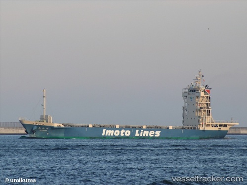
 Mikage
Current Status
Where is the vessel?
Mikage is currently in Near Kobe, based on AIS data received about 1h ago.
Latest AIS update:
Current position: 34.61741° N, 135.26776° E (Near Kobe)
Average speed (last 7 days): Loading…
Average speed (last 30 days): Loading…
Vessel profile: Mikage is a Container Ship with dimensions 95m x 13m.
This page combines live AIS, route history, probable destination signals, nearby traffic, and port activity for practical vessel monitoring.
The current position of vessel Mikage is 34.61741 lat / 135.26776 lng. Updated: 2026-04-10 03:55:27 UTCNearest reference points:
- Near Nada-Ku, Hyogo
- Near Kobe
- Near Hyogo
Currently sailing under the flag of Japan ![]()
Details:
Live Vessel Mikage Analytics (details, animations, etc.)
Recent AIS points (UTC):
2026-04-09 22:19:54 UTC · 34.57761, 135.11636 · SOG 10.1 kn · COG 82°2026-04-09 23:23:34 UTC · 34.63151, 135.29599 · SOG 5.5 kn · COG 62°
2026-04-10 01:52:34 UTC · 34.65543, 135.28752 · SOG 12 kn · COG 203°
2026-04-10 03:55:27 UTC · 34.61741, 135.26776 · SOG 0.2 kn · COG 227°