 vesseltracker.com
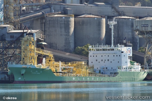
 Taisho Maru
Current Status
Where is the vessel?
Taisho Maru is currently in 15 nm S of Suzuka, based on AIS data received less than 1h ago.
Latest AIS update:
Current position: 34.61718° N, 136.56049° E (15 nm S of Suzuka)
Average speed (last 7 days): Loading…
Average speed (last 30 days): Loading…
Vessel profile: Taisho Maru is a Cement Carrier with dimensions 96m x 96m.
This page combines live AIS, route history, probable destination signals, nearby traffic, and port activity for practical vessel monitoring.
The current position of vessel Taisho Maru is 34.61718 lat / 136.56049 lng. Updated: 2026-04-15 22:07:39 UTCNearest reference points:
- Near TOBA
- Near Yokkaichi
- Near Mihama
Currently sailing under the flag of Japan ![]()
Details:
Live Vessel Taisho Maru Analytics (details, animations, etc.)
Recent AIS points (UTC):
2026-04-15 16:00:47 UTC · 34.62833, 136.58167 · SOG 0 kn · COG -1°2026-04-15 18:00:39 UTC · 34.62833, 136.58167 · SOG 0 kn · COG -1°
2026-04-15 20:12:47 UTC · 34.62833, 136.58167 · SOG 0 kn · COG -1°
2026-04-15 22:07:39 UTC · 34.61718, 136.56049 · SOG 5.4 kn · COG 203°