 vesseltracker.com
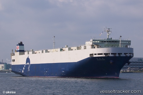
Toyofukumaru
Current StatusWhere is the vessel?
Toyofukumaru is currently in 10 nm E of OHARA, based on AIS data received less than 1h ago.
Latest AIS update:
Current position: 35.24680° N, 140.61121° E (10 nm E of OHARA)
Average speed (last 7 days): Loading…
Average speed (last 30 days): Loading…
Vessel profile: Toyofukumaru is a Vehicles Carrier with dimensions 28m x 165m.
This page combines live AIS, route history, probable destination signals, nearby traffic, and port activity for practical vessel monitoring.
The current position of vessel Toyofukumaru is 35.24680 lat / 140.61121 lng. Updated: 2026-04-07 21:37:55 UTCNearest reference points:
- Near OHARA
- Near ANEGASAKI
- Near KASHIMA
Details:
Live Vessel Toyofukumaru Analytics (details, animations, etc.)
Recent AIS points (UTC):
2026-04-07 16:08:36 UTC · 36.69015, 141.08662 · SOG 16.9 kn · COG 190°2026-04-07 18:14:01 UTC · 36.11807, 140.99222 · SOG 16.2 kn · COG 184°
2026-04-07 20:20:54 UTC · 35.55580, 140.81187 · SOG 16.8 kn · COG 210°
2026-04-07 21:37:55 UTC · 35.24680, 140.61121 · SOG 16.4 kn · COG 209°