 vesseltracker.com
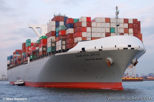
 Manhattan Bridge
Current Status
Where is the vessel?
Manhattan Bridge is currently in Near Long Beach, based on AIS data received about 16h ago.
Latest AIS update:
Current position: 33.74350° N, 118.19448° W (Near Long Beach)
Average speed (last 7 days): Loading…
Average speed (last 30 days): Loading…
Vessel profile: Manhattan Bridge is a Container Ship with dimensions 366m x 51m.
This page combines live AIS, route history, probable destination signals, nearby traffic, and port activity for practical vessel monitoring.
The current position of vessel Manhattan Bridge is 33.74350 lat / -118.19448 lng. Updated: 2026-04-10 07:52:10 UTCNearest reference points:
- Near Long Beach
- Near Los Angeles
- Near Seal Beach
Currently sailing under the flag of Japan ![]()
Details:
Live Vessel Manhattan Bridge Analytics (details, animations, etc.)
Recent AIS points (UTC):
2026-04-10 01:22:10 UTC · 33.74346, -118.19449 · SOG 0 kn · COG 89°2026-04-10 03:34:10 UTC · 33.74353, -118.19439 · SOG 0 kn · COG 89°
2026-04-10 05:49:10 UTC · 33.74346, -118.19450 · SOG 0 kn · COG 89°
2026-04-10 07:52:10 UTC · 33.74350, -118.19448 · SOG 0 kn · COG 89°