 vesseltracker.com
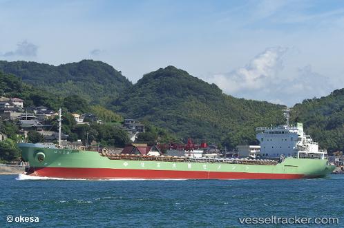
Harima Maru
Current StatusWhere is the vessel?
Harima Maru is currently in Near SENZAKI, based on AIS data received about 3h ago.
Latest AIS update:
Current position: 34.40825° N, 131.22342° E (Near SENZAKI)
Average speed (last 7 days): Loading…
Average speed (last 30 days): Loading…
Vessel profile: Harima Maru is a Limestone Carrier with dimensions 20m x 151m.
This page combines live AIS, route history, probable destination signals, nearby traffic, and port activity for practical vessel monitoring.
The current position of vessel Harima Maru is 34.40825 lat / 131.22342 lng. Updated: 2026-04-12 14:31:17 UTCNearest reference points:
- Near Ube
- Near Shimonoseki
- Near Kokura
Details:
Live Vessel Harima Maru Analytics (details, animations, etc.)
Recent AIS points (UTC):
2026-04-12 07:10:13 UTC · 34.40901, 131.22076 · SOG 0 kn · COG 101°2026-04-12 13:52:10 UTC · 34.40834, 131.22345 · SOG 0 kn · COG 280°
2026-04-12 14:31:17 UTC · 34.40825, 131.22342 · SOG 0 kn · COG 287°
2026-04-12 14:31:17 UTC · 34.40825, 131.22342 · SOG 0 kn · COG 287°