 vesseltracker.com
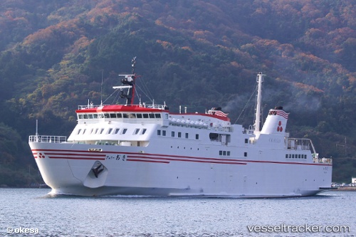
Ferry Oki
Current StatusWhere is the vessel?
Ferry Oki is currently in 16 nm S of NAKANOSHIMA, based on AIS data received about 8h ago.
Latest AIS update:
Current position: 35.85195° N, 133.15688° E (16 nm S of NAKANOSHIMA)
Average speed (last 7 days): Loading…
Average speed (last 30 days): Loading…
Vessel profile: Ferry Oki is a Passenger Ro Ro Cargo Ship with dimensions 17m x 95m.
This page combines live AIS, route history, probable destination signals, nearby traffic, and port activity for practical vessel monitoring.
The current position of vessel Ferry Oki is 35.85195 lat / 133.15688 lng. Updated: 2026-04-10 07:45:18 UTCNearest reference points:
- 37 nm NW of NAKANOSHIMA
- 15 nm NW of SHIMONOHAMA
- 63 nm NW of Unnan
Details:
Live Vessel Ferry Oki Analytics (details, animations, etc.)
Recent AIS points (UTC):
2026-04-10 01:52:36 UTC · 36.07127, 133.33434 · SOG 17.3 kn · COG 8°2026-04-10 03:55:24 UTC · 36.14417, 133.15230 · SOG 16 kn · COG 258°
2026-04-10 04:12:32 UTC · 36.10870, 133.07608 · SOG 10.8 kn · COG 171°
2026-04-10 07:45:18 UTC · 35.85195, 133.15688 · SOG 18 kn · COG 167°