 vesseltracker.com
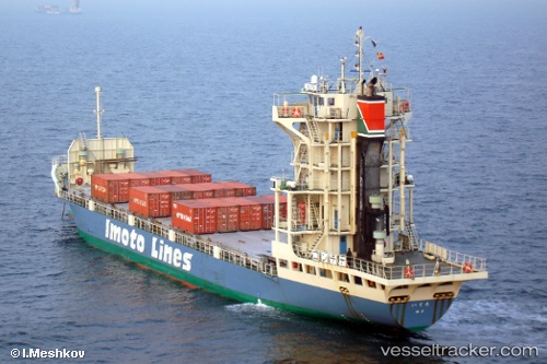
 Ikuta
Ikuta
Current Status
Where is the vessel?
Ikuta is currently in 17 nm SE of HARAMACHI, based on AIS data received about 1h ago.
Latest AIS update:
Current position: 37.50286° N, 141.31290° E (17 nm SE of HARAMACHI)
Average speed (last 7 days): Loading…
Average speed (last 30 days): Loading…
Vessel profile: Ikuta is a Container Ship with dimensions 96m x 14m.
This page combines live AIS, route history, probable destination signals, nearby traffic, and port activity for practical vessel monitoring.
The current position of vessel Ikuta is 37.50286 lat / 141.31290 lng. Updated: 2026-04-14 18:55:33 UTCNearest reference points:
- 18 nm SE of Minamisoma
- 33 nm SE of HARAMACHI
- 32 nm NE of ONAHAMA
Currently sailing under the flag of Japan ![]()
Ikuta built in 2006 year
Deadweight:
1830 tDetails:
Live Vessel Ikuta Analytics (details, animations, etc.)
Recent AIS points (UTC):
2026-04-14 12:39:48 UTC · 38.69231, 141.81105 · SOG 11.9 kn · COG 199°2026-04-14 15:38:50 UTC · 38.12427, 141.56738 · SOG 12 kn · COG 198°
2026-04-14 16:48:51 UTC · 37.90437, 141.47021 · SOG 11.9 kn · COG 198°
2026-04-14 18:55:33 UTC · 37.50286, 141.31290 · SOG 11.8 kn · COG 197°